The Global Positioning System (GPS) has become an essential tool in daily life—guiding travelers, tracking deliveries, syncing time, and even supporting scientific research. But how does this invisible network of satellites know exactly where you are?
What Is GPS?
GPS is a satellite-based navigation system that allows a receiver (like your phone or car) to determine its location anywhere on Earth, at any time, and in any weather. Originally developed by the U.S. Department of Defense, GPS is now freely available for civilian use around the world.
How GPS Determines Your Location
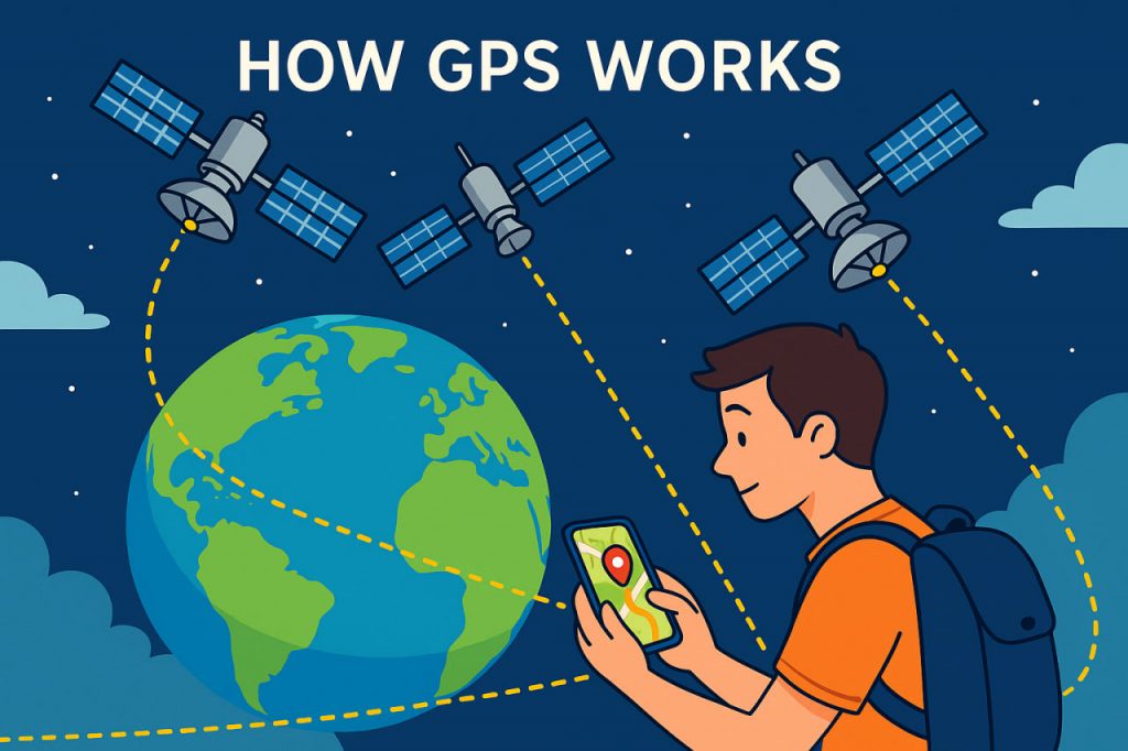
GPS relies on triangulation from satellites orbiting Earth. Here’s how it works:
- At least four satellites are needed to pinpoint your exact location.
- Each satellite broadcasts a signal with the time it was sent and its own position.
- Your device receives these signals and calculates how long each one took to arrive.
- Using this time data, the device determines how far it is from each satellite.
- The distances are used to triangulate your precise location in 3D space—latitude, longitude, and altitude.
The more satellites your receiver connects to, the more accurate the position.
Key Components of the GPS System
- Space segment: Around 30 satellites orbiting Earth at 20,000 km altitude
- Control segment: Ground stations that monitor and adjust satellite positions and clocks
- User segment: Devices (phones, cars, watches) that receive satellite signals
Each satellite carries atomic clocks, which ensure precise timing—a crucial part of GPS accuracy.
How Accurate Is GPS?
Standard GPS is usually accurate to within:
- 5–10 meters for smartphones
- 1–3 meters with high-quality devices
- Centimeters in professional systems with differential GPS (DGPS) or RTK (real-time kinematics)
However, accuracy can be affected by:
- Tall buildings or mountains (signal reflection or blockage)
- Atmospheric conditions
- Poor satellite visibility indoors or underground
Where GPS Is Used
GPS supports a wide variety of industries and daily tasks:
- Navigation: Cars, airplanes, ships, and hikers
- Agriculture: Precision planting and harvesting
- Emergency services: Locating people in distress
- Time synchronization: Financial systems and power grids
- Scientific research: Monitoring earthquakes, tectonics, and climate change
- Fitness and sports: Tracking distance, speed, and routes
Even delivery and ride-sharing apps depend on GPS.
Other Global Navigation Systems
While GPS is American, other countries operate similar systems:
- GLONASS (Russia)
- Galileo (European Union)
- BeiDou (China)
- NavIC (India)
Modern devices often use a combination of these for better accuracy and reliability.
Glossary
- GPS – Global Positioning System: a satellite-based navigation tool
- Triangulation – The process of determining location using distances from multiple points
- Atomic clock – An extremely accurate clock used in GPS satellites
- RTK – A GPS method that offers very high accuracy using ground reference stations
- Satellite – A man-made object orbiting Earth, used to transmit signals