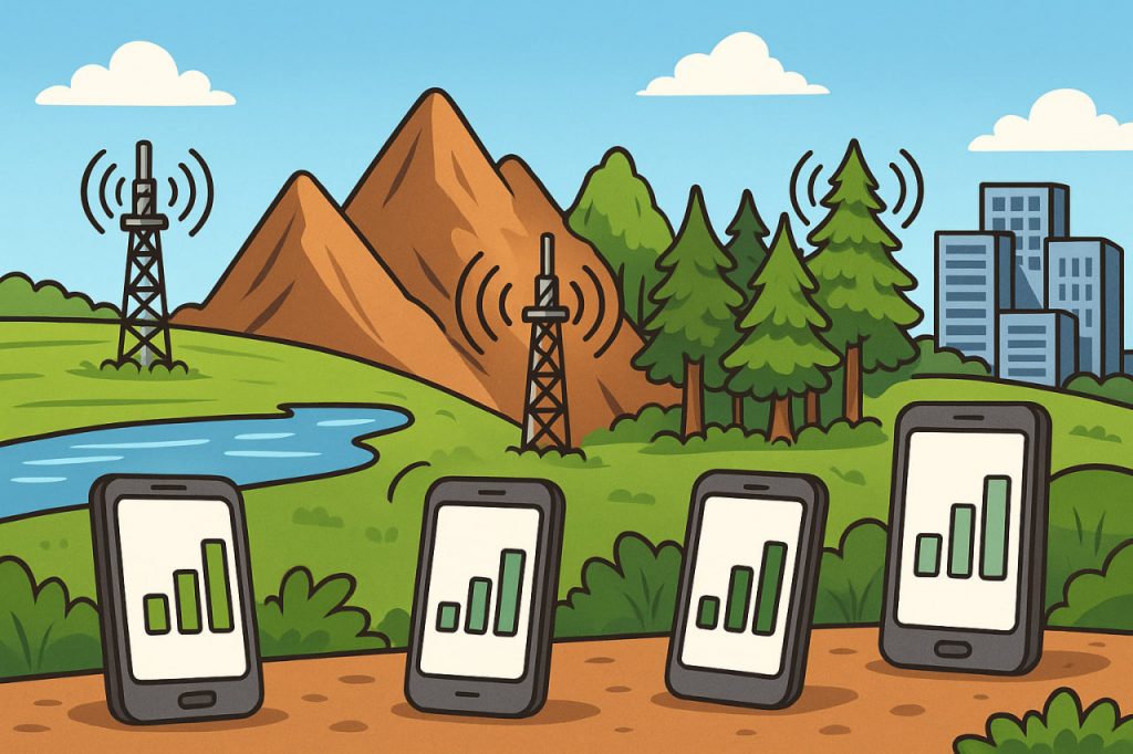
Mobile communication may feel wireless and effortless, but its quality strongly depends on the physical environment. Terrain — the natural shape and features of the land — affects how radio waves travel between cell towers and mobile devices. Hills, mountains, forests, water bodies, and even urban structures can strengthen or weaken the signal. Understanding how terrain influences mobile connectivity helps explain why some regions have excellent coverage while others struggle with dropped calls, low speeds, or unstable connections. Terrain-based challenges shape network design, tower placement, and the technologies used to deliver reliable mobile internet across diverse landscapes.
Mobile networks rely on radio waves that travel through the air, but these waves are sensitive to reflection, scattering, and absorption. Flat, open landscapes allow signals to move freely with minimal interference. In contrast, rugged or densely wooded areas disrupt signal pathways and reduce the effective coverage of cell towers. Engineers must analyze terrain carefully to optimize networks, often combining multiple technologies — from low-frequency bands to small cells and even satellite links — to overcome geographic limitations.
Flat and Open Landscapes: Ideal for Strong Signals
Plains, open fields, coastal regions, and deserts generally provide the best environment for mobile communication. With few obstacles blocking radio waves, signals travel far and maintain strength. As a result, towers can cover wider areas, requiring fewer installations. According to telecommunications specialist Dr. Helena Ward:
“In open terrain, mobile signals behave predictably —
networks are easier to design and performance is usually higher.”
This is why rural flatlands and coastal zones often experience surprisingly good mobile coverage.
Mountainous Regions: The Most Challenging Terrain
Mountains and steep hills significantly obstruct mobile signals. Radio waves cannot easily pass through rock, so coverage drops sharply behind peaks or cliffs. This creates shadow zones, areas where the signal cannot reach. To improve connectivity, engineers may install:
- additional towers at higher elevations
- repeaters in valleys
- specialized directional antennas
Despite these solutions, mountainous terrain remains one of the hardest environments for reliable mobile service.
Forests and Dense Vegetation
Trees, moisture, and vegetation absorb and scatter radio waves. Dense forests weaken high-frequency signals more than low-frequency ones, affecting data speed and connection stability. Seasonal changes also play a role: in summer, thick foliage absorbs more signal; in winter, coverage improves slightly as leaves fall. Forested regions require towers placed closer together or the use of long-range low-band frequencies.
Water Bodies and Coastal Effects
Water interacts differently with radio waves, often improving long-distance travel. Signals can reflect off the water’s surface, extending coverage in some coastal regions. However, large lakes and oceans may also cause interference due to multipath reflections — where signals bounce and arrive at the receiver with delays. Ships and offshore platforms often rely on specialized maritime towers or integrated satellite connections.
Urban Environments: Artificial Terrain Challenges
Cities present terrain-like obstacles in the form of buildings, tunnels, bridges, and metal structures. These materials reflect and block radio waves, creating complex coverage patterns. Tall buildings cast radio “shadows,” similar to mountains. To overcome these challenges, networks use:
- small cells installed on lampposts and rooftops
- 5G nodes placed close together
- indoor repeaters
- beamforming, which directs signals more precisely
Urban networks require high infrastructure density but deliver excellent performance when designed correctly.
How Engineers Adapt Networks to Terrain
Mobile operators use terrain modeling, satellite imagery, and radio-wave simulations to design optimal coverage. They adjust tower height, frequency bands, and antenna orientation depending on local geography. Low-frequency bands (700–900 MHz) penetrate obstacles better and travel farther, making them useful in hilly or forested areas. High-frequency 5G bands offer extreme speeds but require line-of-sight and dense cell deployment.
As network engineer Dr. Marcus Levin explains:
“Terrain defines the limits —
engineering defines how far we can push those limits.”
This balance shapes modern connectivity across diverse landscapes.
Interesting Facts
- Mountains can reduce mobile signal strength by up to 90% behind a peak.
- Low-frequency bands travel 2–3 times farther than high-frequency ones.
- Forest moisture absorbs signals, especially after rain.
- Some coastal regions receive tower coverage from another country due to signal reflection over water.
- Engineers can simulate terrain effects with accuracy up to a few meters using advanced radio-planning software.
Glossary
- Shadow Zone — an area where terrain blocks radio signals.
- Beamforming — directing wireless signals toward a specific device for improved performance.
- Low-Band Frequency — long-range mobile frequencies that penetrate obstacles well.
- Small Cell — compact cellular antenna used to improve urban or terrain-limited coverage.
- Radio Propagation — the behavior of radio waves as they travel through the environment.